
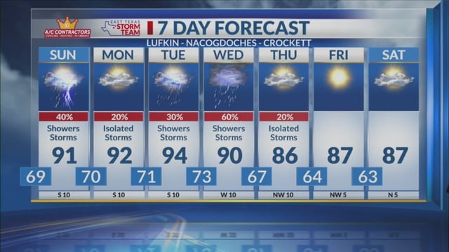


Overview
- Scattered to widespread showers and thunderstorms are expected to ramp up Tuesday–Wednesday from the Midwest and Ohio Valley into parts of the Northeast, with some areas under a marginal severe risk.
- Forecast guidance points to regional totals commonly in the 1–3 inch range through late week, with locally higher amounts possible in slow‑moving storms.
- After a generally pleasant, dry Monday in many markets, humidity increases on Tuesday as a front approaches and taps additional moisture in some regions.
- Temperatures trend seasonable to cooler behind the front, while portions of the South and Southwest stay hot into early week before a modest cooldown.
- Much‑needed rainfall may offer drought relief in spots, though timing and amounts remain uncertain and will be refined with new forecasts.