
Overview
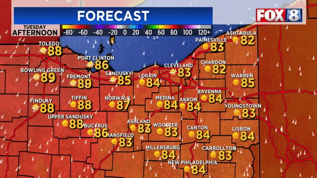
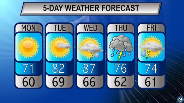
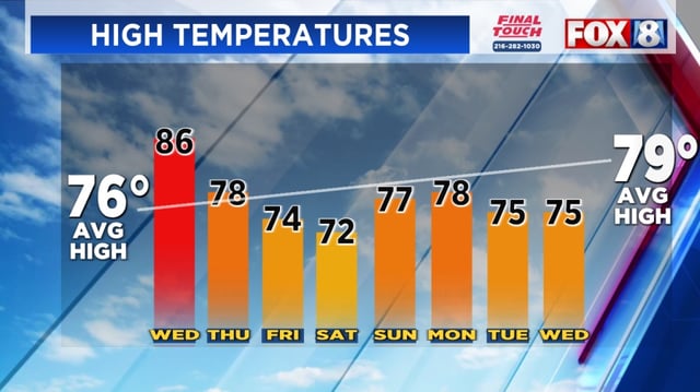
- High temperatures will rise into the mid to upper 80s on Wednesday, marking the warmest day of the week
- Hazy skies from smoke drifting in from wildfires in Alberta, Saskatchewan and Manitoba are expected to clear by daybreak Wednesday as southwesterly winds shift
- A slow-moving cold front will move into the region Wednesday night, triggering showers and scattered thunderstorms through Thursday night
- The Weather Prediction Center has placed all of Ohio under a marginal risk for excessive rainfall on Thursday, raising flash flood concerns in localized areas
- After the front exits by Saturday morning, temperatures are forecast to return to seasonal normals in the mid-70s into the weekend