


Overview
- Scattered showers and isolated storms develop Tuesday, then coverage expands Wednesday into Thursday as waves ride a slow-moving front.
- Projected totals vary widely, from roughly a quarter inch in parts of southern Maine to 1–1.5 inches in portions of the Mid-Atlantic and Northeast where heavier bands form.
- Rain will help chip away at deficits, yet forecasters warn drought persists and the distribution of rainfall will be patchy.
- Summerlike heat lingers across parts of the South and interior areas through midweek before the front ushers in cooler, drier air late week and into the weekend.
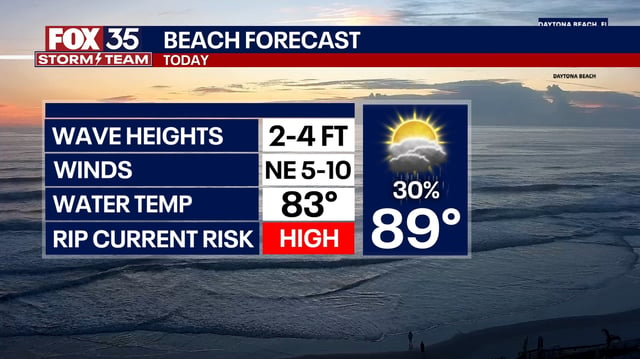
- Localized hazards include a marginal severe threat with gusty winds and hail in sections of the Plains and South, areas of dense post-rain fog, and ocean swells from Hurricane Gabrielle as it tracks away from Bermuda.