
Overview
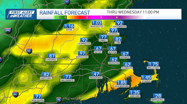
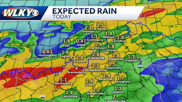
- Rain spreads in late Tuesday night and tapers from west to east by midday Wednesday, with many areas forecast to receive about 0.5 to 1 inch.
- Some locales could see heavier pockets of rain, with several forecasts allowing for localized totals near or above 1 to 1.5 inches.
- Travel hazards are expected for the first wet morning in days, including slick roads, hydroplaning risk and brief ponding in heavier bands.
- Much cooler air follows the front, with highs dropping into the 50s and 60s and a notable frost or freeze risk inland by Thursday and Friday mornings.
- Meteorologists say the rainfall will be beneficial yet insufficient to erase ongoing dryness, and they are monitoring an uncertain coastal or tropical system for late weekend.