Overview
- Overnight into Wednesday brought widespread rain totals of roughly 0.5 to 1.5 inches, with localized downpours topping 1 to 2 inches and brief, isolated flood concerns in a few spots.
- Showers impacted several morning commutes before tapering west to east by late morning to midday, with clearing progressing through the afternoon.
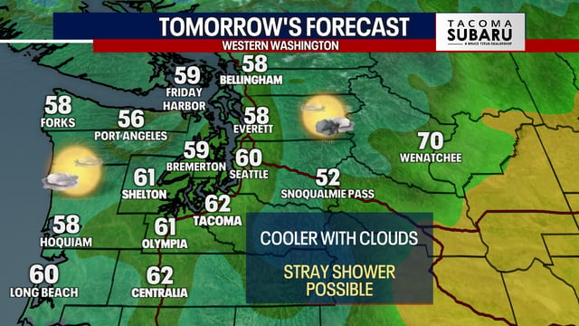
- Behind the front, breezy northerly winds are driving in much drier air and a marked cool-down, with many areas running 15 to 20 degrees lower than earlier this week.
- Inland lows are forecast to fall into the 30s over the next 24–48 hours, posing a risk for the season’s first patchy to widespread frost in typically colder locations.
- The rainfall is welcome in drought-affected areas but, given its uneven distribution, is not expected to erase longer-term deficits.


