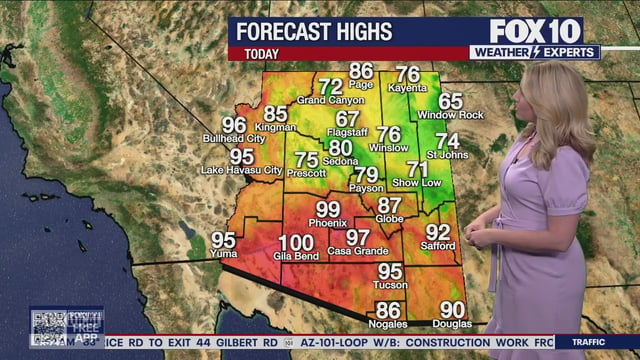
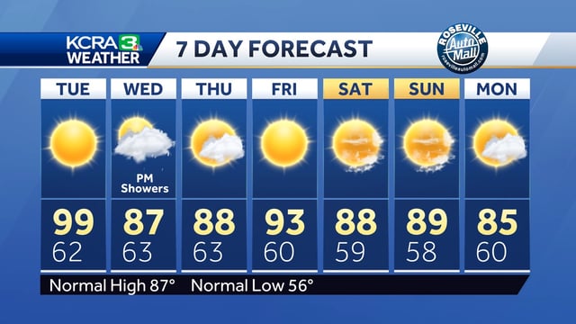

Overview
- Showers and scattered storms are expanding Tuesday, with the most widespread and heaviest rain expected from Wednesday into Thursday.
- Rainfall of roughly 1 to 1.5 inches is possible where bands set up, and localized flooding is a risk during heavier downpours with gusty winds.
- The severe threat is generally marginal, though a few stronger storms could produce damaging wind or small hail in some areas.
- High-elevation snow levels in the Rockies are forecast to fall to about 9,000–10,000 feet late tonight, and dense valley fog may reduce visibility into early Wednesday.
- Behind the front, cooler and less humid weather builds in for the weekend with more sunshine and improving travel conditions.