
Overview
- SMN forecasts 75–150 mm downpours in western Oaxaca and western Chiapas, 50–75 mm in Sonora, Chihuahua, Sinaloa, Michoacán, Guerrero, Veracruz, Yucatán and Quintana Roo, and 25–50 mm in Coahuila, Nuevo León, Tamaulipas, Durango, Nayarit, Jalisco, Colima, Estado de México, Morelos, Puebla, Tabasco and Campeche.
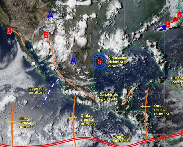
- The setup features the Mexican monsoon interacting with low‑pressure channels, atmospheric instability and tropical waves 23 and 24, supporting widespread thunderstorms with lightning and possible hail.
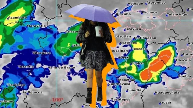
- For the Valley of Mexico, a cool morning with partial cloud and fog in high areas gives way to a warmer afternoon with isolated showers in CDMX and stronger 25–50 mm chubascos in Estado de México, with temperatures near 13–15°C/25–27°C in CDMX and 8–10°C/21–23°C in Toluca.
- La Magdalena Contreras is forecast as Mexico City’s coldest borough, near 10°C around 6 a.m.
- Authorities highlight risks including urban flooding, landslides, reduced visibility and possible hail, and Mexico City’s SGIRPC urges layered clothing and shares emergency lines 911, 55 5658 1111 (Locatel) and 55 5683 2222.