

Overview
- Mexico’s weather service forecasts torrential rain of 150–250 mm in parts of San Luis Potosí, Querétaro, Hidalgo, Puebla, Veracruz, Guerrero and Oaxaca, with additional intense rainfall across the northeast, center and southeast.
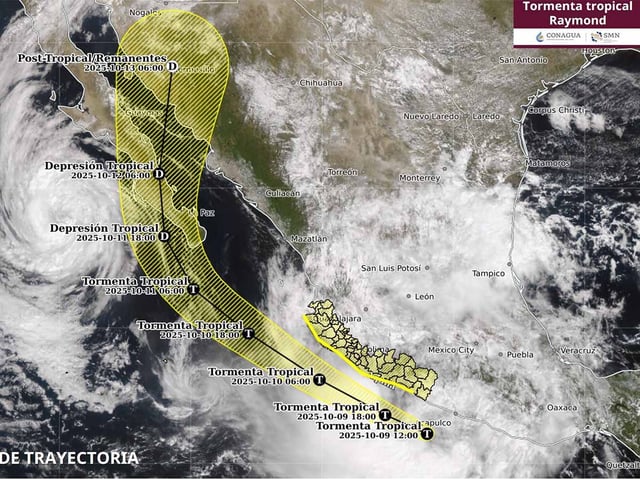
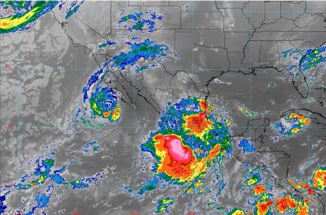
- Tropical Storm Priscilla continues parallel to Baja California Sur with strong winds and elevated surf, while newly formed Raymond near the Guerrero–Michoacán–Colima–Jalisco coasts brings 70–90 km/h gusts, 4–5 m waves and a risk of marine waterspouts.
- Authorities caution that storms may trigger river rises, flash flooding, urban inundation, landslides, lightning and hail, and warn that strong gusts could down trees and signage.
- Mexico’s national civil protection agency has deployed liaison and coordination missions to Veracruz, Chiapas and Oaxaca as forecasts highlight dangerous conditions overnight and into the weekend.
- A cold front moving into Baja California is set to drop mountain temperatures below freezing and produce strong winds and rough seas, while Argentina’s meteorological service issues yellow alerts for wind, rain and Zonda, and Catalonia activates a yellow alert for DANA Alice.