

Overview
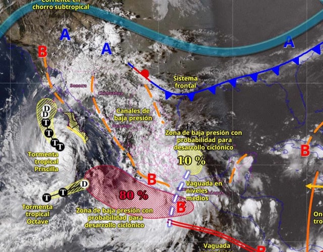
- SMN and Conagua forecast heavy to torrential rainfall today, with 150–250 mm possible in parts of San Luis Potosí, Querétaro, Hidalgo, Puebla, Veracruz, Guerrero and Oaxaca.
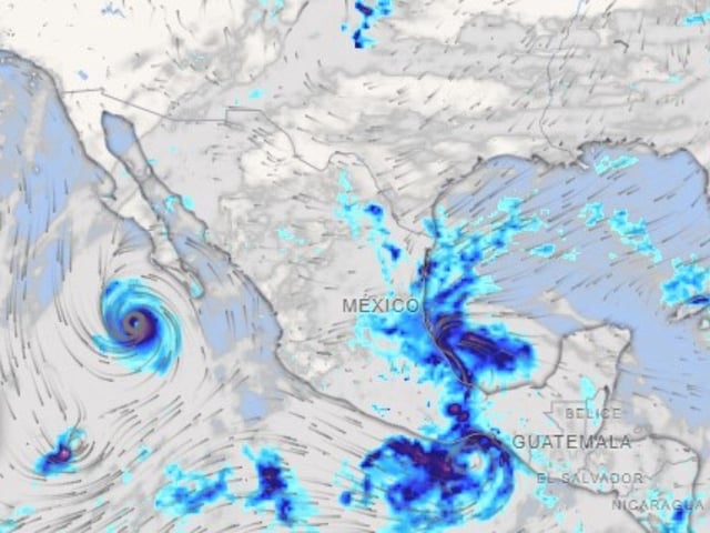
- Priscilla continues moving parallel to Baja California Sur and a high‑probability low‑pressure area off Guerrero and Michoacán is reinforcing widespread showers, thunderstorms and strong winds.
- Coastal hazards include very strong winds and elevated surf along Oaxaca, Guerrero, Michoacán and Colima, and authorities urge caution for maritime activities.
- Mexico City’s civil protection agency activated alerts for multiple boroughs, warning of strong rain, possible hail and wind gusts, and advising residents on safety measures.
- Forecasters expect the rainy pattern to gradually weaken in central regions in the second half of October, while southern and southeastern states may see persistent rainfall into early to mid‑November.