

Overview
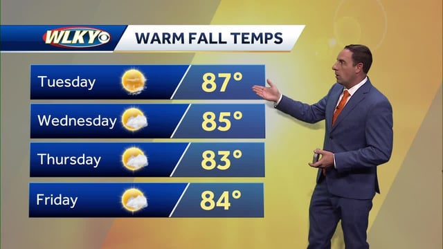
- Highs widely reach the 80s to near 90 from the Midwest to the Ohio Valley and Plains, running roughly 10–15 degrees above normal.
- New England is seeing a short midweek chill with highs near 60, northeast gusts up to 30–40 mph along the coast, and patchy frost possible in interior valleys.
- Hurricanes Humberto and Imelda remain offshore but are generating 6–10 foot waves, a high rip-current risk, and minor tidal flooding at some East Coast locations on Wednesday.
- Forecasts indicate little to no rain through the weekend in many areas, with broader precipitation chances not favored until around Oct. 7–8.
- Cities including the Twin Cities, Kansas City, Louisville and Des Moines are expected to stay warm and mostly sunny through the weekend, with occasional breezy conditions.