Overview
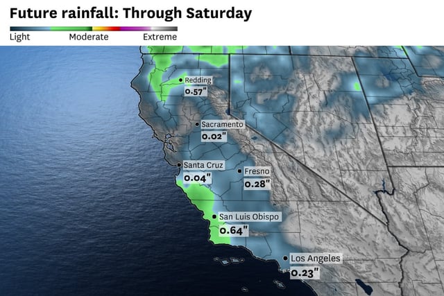
- The Bay Area will see light rain starting late Friday, with most areas receiving less than a tenth of an inch and higher elevations potentially seeing up to 0.25 inches.
- Forecasts indicate a small chance (under 15%) of isolated thunderstorms, with possible pea-sized hail and lightning strikes in select areas.
- Onshore winds are expected to strengthen, with gusts reaching 25–35 mph through coastal gaps and ridgelines, contributing to cooler and cloudier conditions.
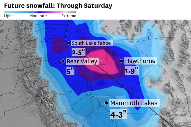
- Snow levels in the Sierra Nevada will drop to 5,000–6,000 feet, with 1–2 inches of slushy snow likely in passes and higher elevations seeing several inches.
- The storm's impacts will vary regionally, with the Central Coast and Southern California forecasted to experience more significant rain and thunderstorm activity compared to the Bay Area.