


Overview
- S. Jaishankar’s written reply in the Rajya Sabha addressed concerns raised by MP Randeep Singh Surjewala about the circulation of the controversial map.
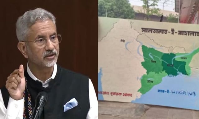
- The map was displayed at Dhaka University during the April 14 Pohela Boisakh exhibition and portrayed Bihar, Jharkhand, Odisha, the entire Northeast and Myanmar’s Arakan State as part of ‘Greater Bangladesh’.
- Bangladesh’s official fact-checking platform, BanglaFact, found no evidence of Saltanat-e-Bangla operating in the country and said the map referenced an earlier Bengal Sultanate exhibit.
- Organizers of the Dhaka University exhibition denied any links to foreign political entities amid reports of backing by the Turkish Youth Federation.
- The Indian government affirmed it will continue to monitor Turkish and Pakistani NGO activities in Bangladesh for potential national security implications.