
Overview
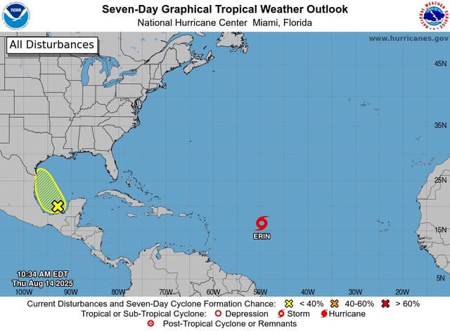
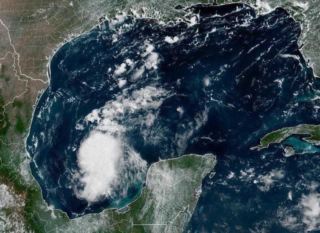
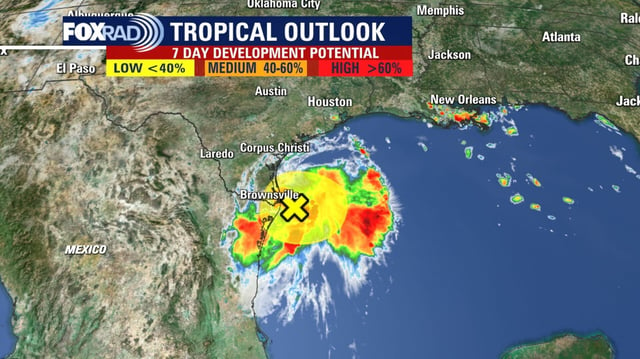
- On Friday, Invest 98L moved ashore across northern Mexico and South Texas without sustaining a closed circulation, prompting the National Hurricane Center to reduce its formation probability from about 50% to near zero.
- Remnant tropical moisture has generated scattered showers and isolated heavy downpours, resulting in minor flash flooding in coastal and low-lying regions of South Texas.
- National Weather Service offices in Corpus Christi and Brownsville have maintained rip current advisories for beaches from South Padre Island to Matagorda Island.
- U.S. Air Force Reserve Hurricane Hunter reconnaissance confirmed the disturbance’s disorganization, and forecasters do not anticipate further tropical development.
- Showers are expected to diminish over the weekend, giving way to rising temperatures and drier conditions across South Texas and northeastern Mexico.