Particle.news

Download on the App Store

Invest 93L Off Florida Coast Has 40% Chance to Become Tropical Storm Dexter

Heavy rainfall will cause flash flooding across Central Florida roads before the low reaches the Gulf.

A map from the NHC shows there is a 40 percent chance Tropical Storm Dexter will form within 48 hours.
Invest 93L, seen in this weather satellite photo as a cluster of clouds off Florida’s Atlantic coast Tuesday morning, has produced downpours across the Sunshine State. The tropical disturbance is expected to push across the peninsula and emerge over the northeastern Gulf of Mexico by Wednesday morning.
Here is a weather satellite view of a tropical disturbance over northern Florida, as of 10:30 a.m. Tuesday.
A pedestrian makes his way along a street during a rain shower Tuesday, July 15, 2025, in Orlando, Fla. (AP Photo/John Raoux)

Overview

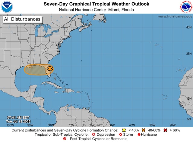
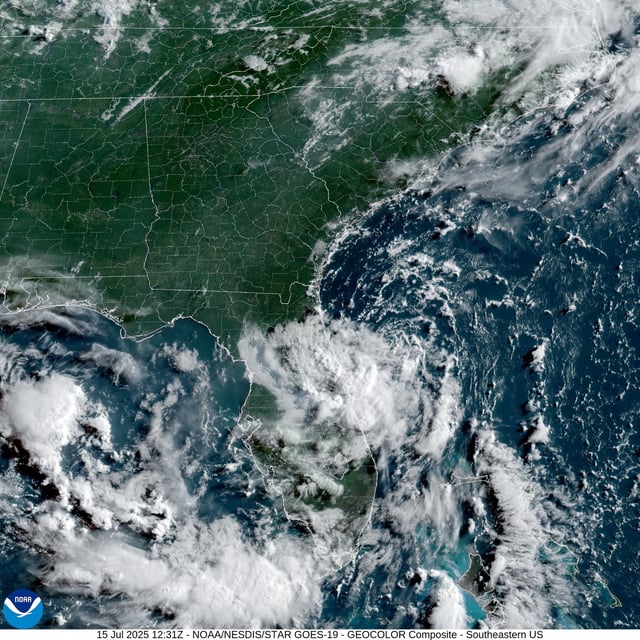
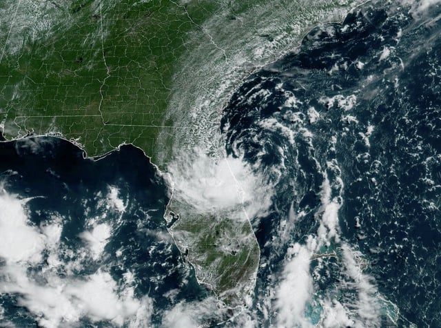
  • Invest 93L sits off Florida’s east coast and is forecast to move westward across the peninsula into the northeastern Gulf by midweek.
  • The National Hurricane Center has raised development odds to 40% over the next seven days and the system would become Tropical Storm Dexter if conditions allow.
  • Central Florida has experienced torrential downpours, with a gauge in Plant City recording 10.62 inches of rain and prompting localized flash flood alerts.
  • Severe storms have disrupted travel in Central Florida, delaying over 250 flights at Orlando International Airport and triggering an FAA-ordered ground stop.
  • Escalating winds in the Gulf are expected to generate rough surf and dangerous rip currents along the Gulf Coast later this week.