Particle.news

Download on the App Store

Invest 93L Enters Gulf With 40% Chance of Becoming Tropical Storm Dexter

Heavy rains from the system pose flash flood threats from Florida to the Louisiana coast

A map from the NHC shows there is a 40 percent chance Tropical Storm Dexter will form within 48 hours.
Image
Invest 93L, seen in this weather satellite photo as a cluster of clouds off Florida’s Atlantic coast Tuesday morning, has produced downpours across the Sunshine State. The tropical disturbance is expected to push across the peninsula and emerge over the northeastern Gulf of Mexico by Wednesday morning.
Invest 93L is just to the right of a cluster of clouds seen here in a weather satellite photo of the Gulf of Mexico taken Wednesday morning. The center of circulation of the tropical disturbance was in the Florida Panhandle early Wednesday, but the heaviest rainfall associated with Invest 93L is far removed from its center.

Overview

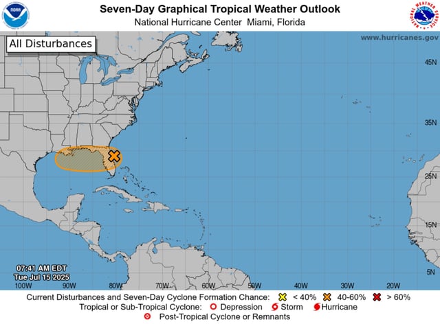
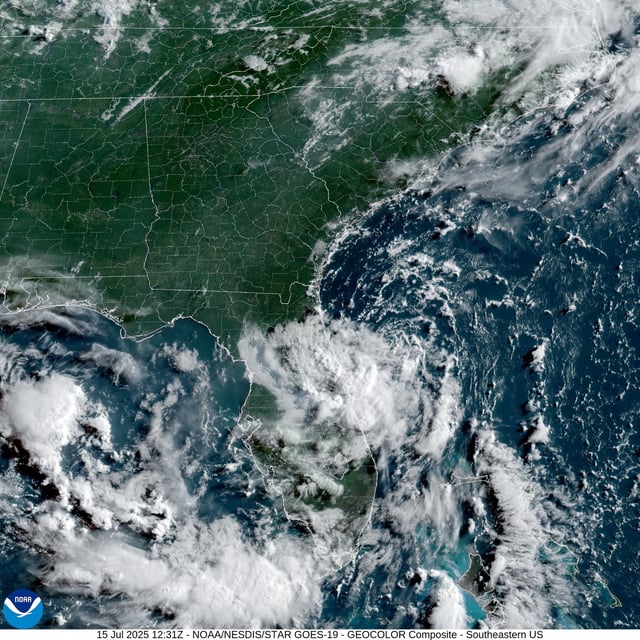
  • The National Hurricane Center says the broad low-pressure area now over the northeastern Gulf has a sustained 40% chance of tropical cyclone formation in the next two to seven days
  • Central Florida continues to grapple with flash flooding after Plant City recorded over 10 inches of rain on July 14
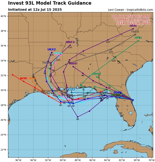
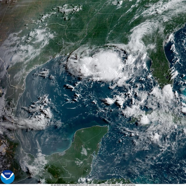
  • Forecast models track Invest 93L westward toward Louisiana, where it is expected to reach the coast by Thursday
  • Record-warm Gulf waters and low wind shear could help the disturbance organize into Tropical Storm Dexter, the fourth named storm of the season
  • Most of Texas is likely to avoid significant impacts, though far eastern counties may see some rainfall late this week