Particle.news

Download on the App Store

Invest 93L Brings Flood Watches, Flight Delays to Florida as It Moves Toward Gulf

The National Hurricane Center now gives the system a 40 percent chance of tropical storm formation once it reaches the Gulf midweek.

A map from the NHC shows there is a 40 percent chance Tropical Storm Dexter will form within 48 hours.
Invest 93L, seen in this weather satellite photo as a cluster of clouds off Florida’s Atlantic coast Tuesday morning, has produced downpours across the Sunshine State. The tropical disturbance is expected to push across the peninsula and emerge over the northeastern Gulf of Mexico by Wednesday morning.
Here is a weather satellite view of a tropical disturbance over northern Florida, as of 10:30 a.m. Tuesday.
A pedestrian makes his way along a street during a rain shower Tuesday, July 15, 2025, in Orlando, Fla. (AP Photo/John Raoux)

Overview

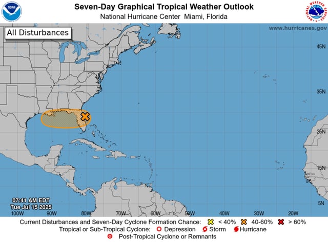
  • The National Hurricane Center has raised Invest 93L’s odds of development to a medium 40 percent over the next seven days, with similar chances in the next 48 hours.
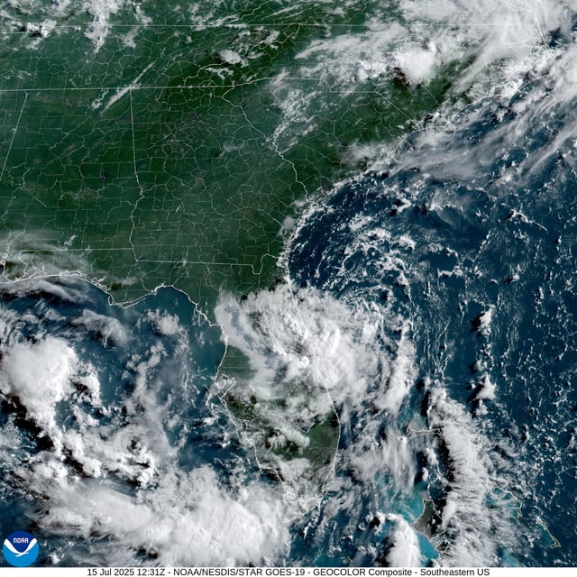
  • The broad low pressure moving across Central Florida has already produced up to 10.62 inches of rain near Plant City and widespread totals of 2 to 5 inches.
  • Flood watches issued by the National Weather Service cover millions of residents across central and western Florida counties through midweek.
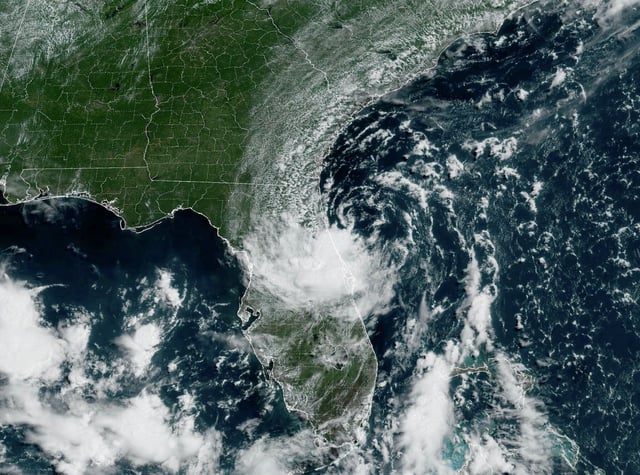
  • Severe downpours at Orlando International Airport led to more than 250 flight delays as storms stalled operations on Monday and Tuesday.
  • Forecast models project Invest 93L to cross the Florida Peninsula and emerge over the northeastern Gulf by Wednesday, where warm waters and low wind shear may favor further organization.