


Overview
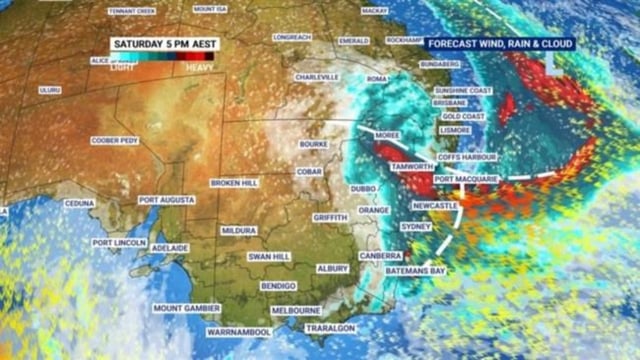
- Forecasts call for 100–150 mm of rain across the Mid North and South Coast catchments from Friday night to Sunday, prompting flood watches for more than a dozen river valleys.
- Damaging wind gusts up to 90 km/h are expected near the system’s centre on Saturday, with severe weather warnings in force along the NSW coastline.
- Offshore seas could build to 10 metres at times, raising coastal erosion risks and triggering hazardous surf alerts from the Central Coast to the state’s northern rivers.
- Snow showers may develop in high-elevation zones—including the Snowy Mountains, Barrington Tops and Granite Belt—where polar air clashes with onshore moisture.
- The storm’s effects will extend into southern Queensland before the low slowly drifts east and conditions begin to ease by Monday.