


Overview
- National weather alerts from INMET for October 9–10 flag intense precipitation of 20–30 mm per hour or up to 50–100 mm in a day and gusts broadly in the 40–60 km/h range, with isolated higher peaks depending on locality.
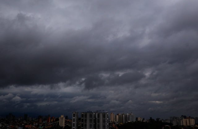
- The São Paulo coast logged 81.2 mm in 24 hours at Iguape and remains under risk of persistent rain, while the capital holds a yellow alert for downpours up to 50 mm/day, gusts near 60 km/h, and unusually cool temperatures.
- Goiás reported damage from short‑lived but severe storms with hail and estimated gusts near 50–60 km/h in cities such as São Luís de Montes Belos and Porangatu, with forecasters noting irregular pre‑season thunderstorms over lingering heat.
- Forecasts for Friday indicate continued instability across large areas: stronger cells over parts of the North, increasing showers in Mato Grosso, Mato Grosso do Sul and Goiás, and a cloudy, cooler pattern over São Paulo and Rio de Janeiro.
- Climatempo projects an extratropical cyclone forming near Uruguay late Sunday into Monday that could deliver 80–100 km/h gusts along the southern coast, with the associated front likely driving blustery conditions farther north; civil defense guidance remains in effect.