


Overview
- Lt Gen Rajiv Kumar Sahni said 23 indigenous applications fused multi‑source inputs to give commanders a single, real‑time operational picture during the operation.
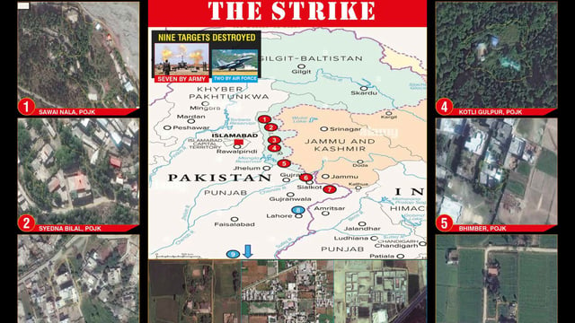
- Battlefield models drew on 26 years of recorded radio emissions and frequency signatures to help predict locations of enemy guns, missile units and other assets.
- An in‑house electronic‑intelligence collation tool was rapidly modified to locate enemy sensors and produce a common surveillance picture for target acquisition.
- AI‑enabled meteorology, including forecasts about 200 km into enemy territory and apps such as Anuman 2.0, supported long‑range engagement planning with wind and trajectory data.
- Officials highlighted a broader push to institutionalize AI with the 2024–25 Year of Technology Absorption, the Bengaluru‑based AARIC, and work on a unified AI platform integrating operations, intelligence, logistics and training.