

Overview
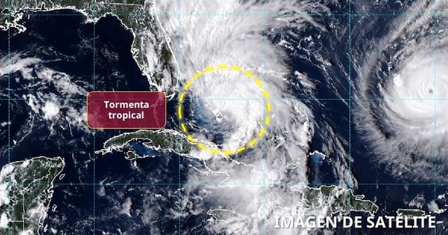
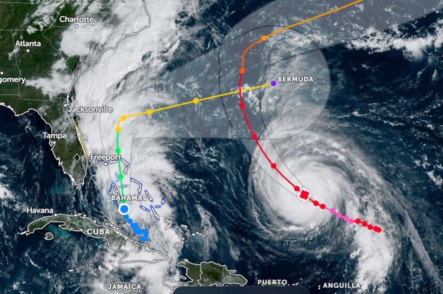
- The National Hurricane Center says Imelda is moving north near the Bahamas with sustained winds around 45 mph and is forecast to become a Category 1 hurricane as it turns east‑northeast away from the Southeast coast by midweek.
- Recent model guidance keeps the center offshore; a Florida Atlantic coast tropical storm advisory was canceled Sunday night, though dangerous surf, rip currents and coastal flooding remain likely from Florida to the Carolinas.
- Tropical storm warnings remain in parts of the Bahamas, where 6 to 12 inches of rain and storm surge of 1 to 3 feet could trigger flash flooding and coastal inundation.
- South Carolina and North Carolina have declared states of emergency, and coastal cities including Charleston have deployed sandbags, cleared drains and staged search‑and‑rescue teams.
- Major Hurricane Humberto, still a Category 4, is influencing Imelda’s track and is prompting a tropical storm alert in Bermuda, which could see impacts from both systems; authorities reported a rip‑current fatality in Volusia County, Florida.