
Overview
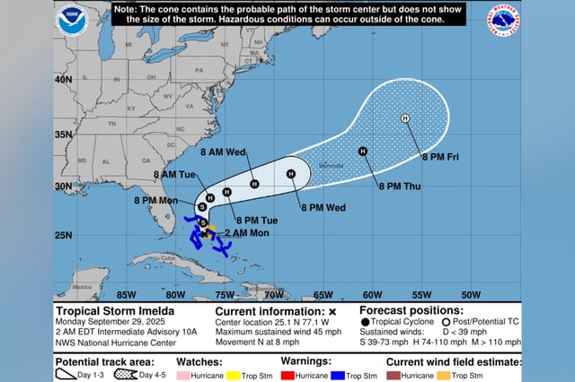
- As of early Monday, the National Hurricane Center placed Imelda about 315 miles southeast of Cape Canaveral with 45 mph winds and projected it will reach hurricane strength by Tuesday.
- Even with an offshore track, forecasters expect dangerous surf, life‑threatening rip currents, beach erosion and pockets of coastal flooding from Florida to the Carolinas.
- Bahamas islands remain under tropical storm warnings with 4 to 8 inches of rain, a possible 1 to 3 foot storm surge and continued travel disruptions that stranded some Nassau passengers.
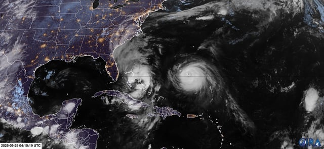
- Hurricane Humberto, still a powerful Category 4 after briefly hitting Category 5, is influencing Imelda’s turn away from the U.S. shoreline and will amplify hazardous seas along the East Coast.
- South Carolina activated emergency measures, including a statewide emergency declaration and Charleston’s local order, while Bermuda prepares for Humberto followed by a possible closer pass from Imelda midweek.