
Overview
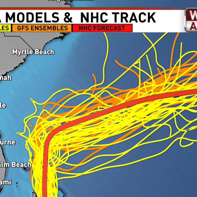
- Imelda became a tropical storm Sunday and is forecast to strengthen into a hurricane by Monday night or early Tuesday, according to the National Hurricane Center.
- Most guidance shows a northward move Monday followed by a quick east or northeast turn Monday night into Tuesday, influenced by nearby Hurricane Humberto, though some track uncertainty persists.
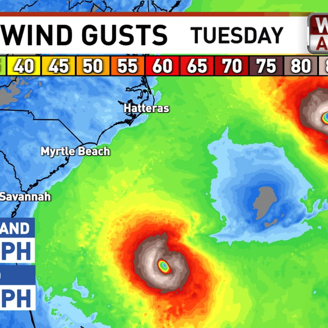
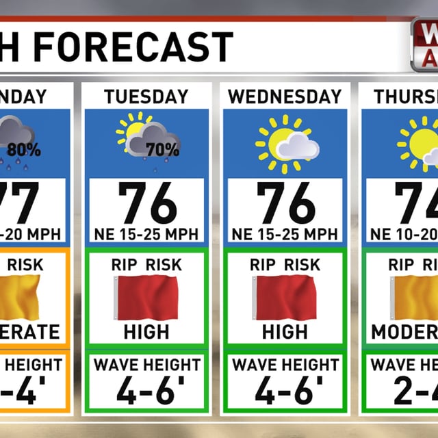
- NHC expects 2 to 4 inches of rain with isolated 6 inches across coastal South Carolina into southeast North Carolina through Tuesday, with a high rip current risk and minor coastal flooding possible from Florida to the Outer Banks.
- Tropical storm watches for Florida’s east coast were discontinued, but offshore marine warnings remain in effect as rough surf, dangerous currents and gusty winds continue into midweek.
- North and South Carolina declared states of emergency as coastal preparations ramp up, while inland areas like the Piedmont Triad are forecast to see modest rain totals around 0.5 to 1 inch and lower wind impacts; the Bahamas are experiencing tropical-storm conditions.