

Overview
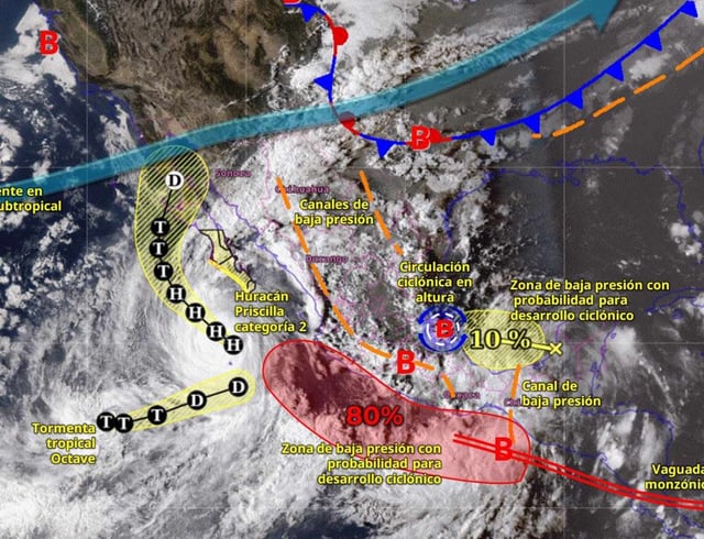
- Priscilla, now a Category 1 system, is positioned roughly 310 km southwest of Cabo San Lucas, driving very strong winds and 5–6 meter surf along Baja California Sur’s west coast with additional bands bringing rain to Sinaloa and Nayarit.
- Conagua reports a low‑pressure area about 170 km south of Salina Cruz with a 70% chance of cyclogenesis in 48 hours and 80% in seven days, moving west‑northwest at 16–24 km/h and potentially taking the name Raymond if it develops.
- SMN forecasts today call for torrential rain totals of 150–250 mm in parts of Hidalgo, Puebla, Oaxaca and Veracruz, with intense to very strong accumulations in San Luis Potosí, Querétaro, Tabasco and Chiapas, and widespread strong storms across additional states.
- Outlooks for Thursday and Friday highlight continued dangerous conditions, including torrential rain risks in San Luis Potosí, Querétaro, Hidalgo, Puebla, Veracruz and Oaxaca, coastal wind gusts up to 70–90 km/h and seas building to 3.5–4.5 m on sections of the Pacific coast.
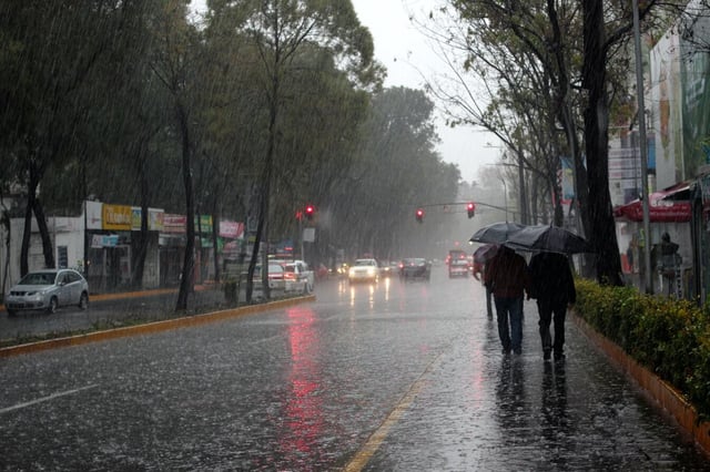
- Mexico City is forecast for 25–50 mm and showers from around midday into the night, the State of Mexico for 50–75 mm, and forecasters flag Friday as the week’s peak for the capital, with authorities warning of urban flooding, landslides and hazardous surf.