

Overview
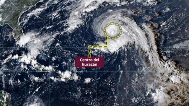
- Narda is positioned southwest of Jalisco as a hurricane, sending outer bands that are producing very heavy rain, strong gusts and elevated seas along coasts of Jalisco, Colima, Michoacán and Guerrero.
- SMN forecasts rainfall totals reaching the intense range of 75–150 mm in parts of the west and south, with coastal waves of 2.5–3.5 meters and wind gusts generally 50–70 km/h.
- Forecast guidance indicates the system will continue moving west-northwest away from land with no direct landfall expected, though it could peak near Category 2 as effects gradually diminish later in the week.
- Protección Civil urges residents to avoid sea activities, follow port authority instructions, refrain from crossing rivers or streams and monitor SMN and Conagua updates.
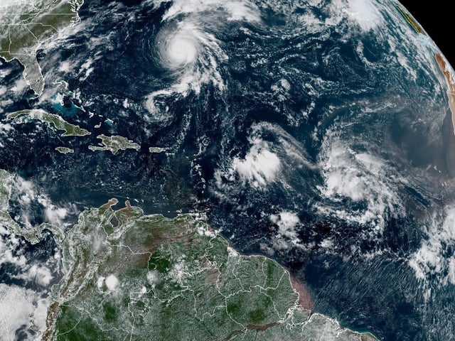
- Cold Front No. 4 is approaching the north with additional showers and strong winds (50–70 km/h) and potential vortex formation, while Tropical Wave 34 and the monsoon sustain heavy rains from the southeast to the Yucatán Peninsula.