


Overview
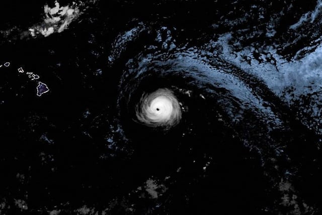
- Air Force Reserve reconnaissance late Saturday found maximum sustained winds near 125 mph and a central pressure of 960 mb, placing Kiko about 785 miles east of Hilo and moving west-northwest.
- Forecast guidance indicates gradual weakening over cooler waters with increasing dry air and wind shear, and a track that takes the storm north of the islands between September 9 and 11, though details remain uncertain.
- Swells are expected to reach the Big Island and Maui beginning Sunday and build through midweek, producing hazardous surf and life-threatening rip currents, especially along east-facing shores.
- Acting Governor Sylvia Luke’s September 5 emergency proclamation runs through September 19 and authorizes activation of the Hawaiʻi National Guard, use of the Major Disaster Fund, and temporary suspension of certain state laws to speed response.
- NWS and state emergency officials say wind and rain impacts are possible early next week but the location and magnitude are not yet known, and no watches or warnings had been issued at the time of the latest advisory.