


Overview
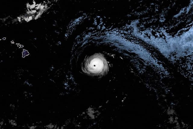
- As of Monday evening in Hawaii, Kiko was a Category 1 hurricane with 75 mph winds about 300 miles east‑northeast of Hilo and is forecast to pass north of the islands Tuesday into Wednesday.
- Forecasters expect the system to downgrade to tropical storm strength overnight as cooler water, wind shear and dry air continue to weaken it.
- Swells are building from east to west and are forecast to peak late Monday through Wednesday, producing life‑threatening surf and rip currents along east‑facing shores.
- NWS Honolulu says the dangerous surf will reach Hilo first, with high‑surf warnings likely, and urges residents and visitors to stay out of the water and keep monitoring forecasts.
- A statewide emergency remains in effect, authorizing the Hawaiʻi National Guard and disaster funds and suspending some rules for faster response, and there are no hurricane watches or warnings for land areas.