
Overview
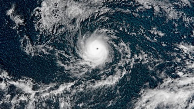
- The National Hurricane Center said Kiko weakened from a Category 4 peak to about 125 mph winds, located roughly 1,360 miles east-southeast of Hilo and moving west at around 9 mph in its latest update.
- Kiko is forecast to approach the Hawaiian Islands in the early to middle portion of next week, and the NHC says the risk of direct impacts from wind and rainfall is increasing.
- Swells generated by the hurricane are expected to reach the islands toward the end of the weekend, bringing life-threatening surf and rip currents.
- Forecasters note significant uncertainty on final intensity and track because cooler waters and trade winds could weaken the system before it nears the islands.
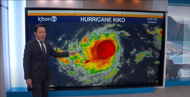
- Some model guidance shows possible effects on Oʻahu, including tourist areas such as Disney’s Aulani Resort, though no watches or warnings are in effect as the storm remains far from land.