Overview
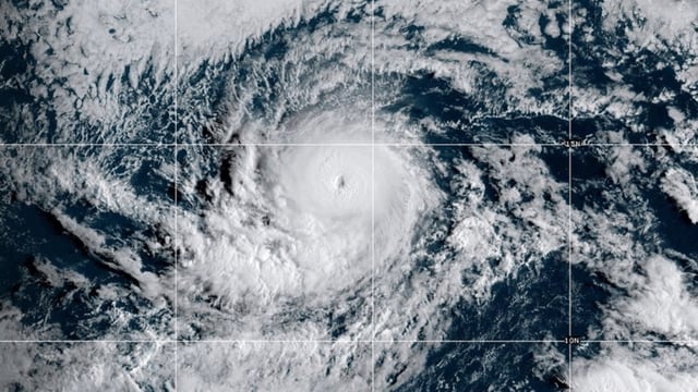
- As of late Friday, Kiko was a Category 4 hurricane with 140 mph winds about 1,130 miles east-southeast of Hilo, moving west-northwest at roughly 12 mph.
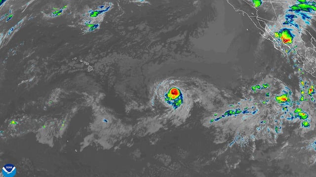
- Forecasters say the storm could pass near or impact Hawaii early to mid next week, though the exact track and severity remain uncertain.
- Swells are forecast to reach the islands by the end of the weekend, producing life-threatening surf and rip currents, according to the National Hurricane Center.
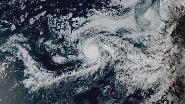
- Kiko is expected to weaken before nearing Hawaii as it encounters cooler water, stronger wind shear and drier air, with possible eyewall replacement cycles driving short-term intensity changes.
- No coastal watches or warnings are in effect for Hawaii, while Lorena’s post-tropical remnants continue to bring a flash-flood and mudslide threat to parts of western Mexico with isolated heavy rain possible in Arizona and New Mexico.