Overview
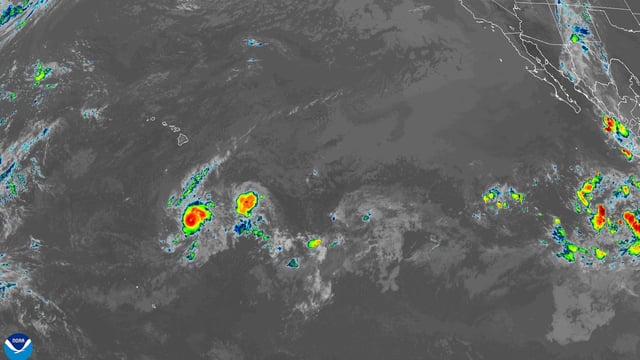
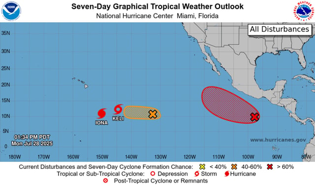
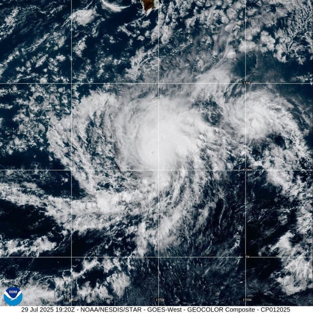
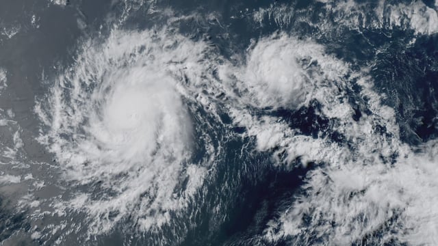
- Iona became the first hurricane of the central Pacific season after its winds surged to near 115 mph overnight, elevating it to a Category 3 storm.
- The hurricane is moving westward at about 13 mph roughly 800 miles south of Honolulu with no coastal watches or warnings in effect.
- National Hurricane Center forecasts call for Iona to peak in intensity tonight then undergo gradual weakening by Wednesday while remaining offshore.
- Tropical Storm Keli, which formed about 18 hours after Iona with 40 mph winds, is also tracking west and poses no direct threat to the Hawaiian Islands.
- Forecasters are monitoring two eastern Pacific disturbances that carry 60% and 90% chances of tropical development over the next 48 hours and seven days, respectively.