Overview
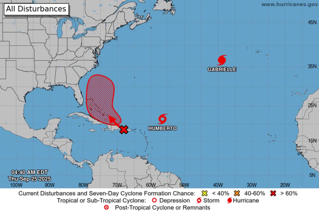
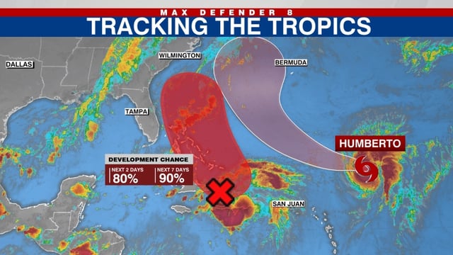
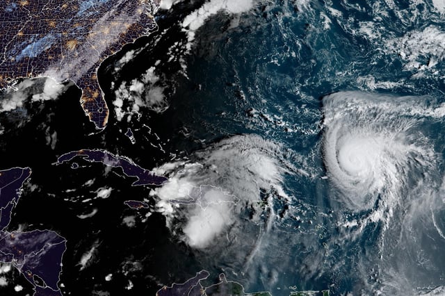
- Tropical Storm Humberto became a Category 1 hurricane with 75–90 mph winds and is forecast by the National Hurricane Center to reach major strength this weekend while tracking slowly northwest.
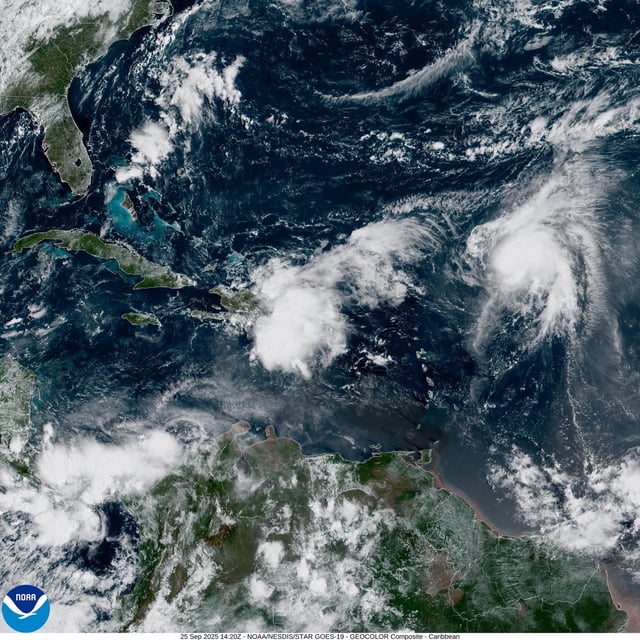
- Showers and storms near Hispaniola and the Turks and Caicos (Invest 94L) are expected to consolidate near the southeast Bahamas, with an 80% chance of formation in 48 hours and 90% over seven days.
- The NHC says the likelihood of wind, rainfall, and storm‑surge impacts for parts of the Southeast U.S. coast is increasing late this weekend into early next week, though specific track and intensity remain uncertain.
- Meteorologists are watching for possible Fujiwhara interaction between Humberto and the developing system, and models diverge on outcomes, with scenarios ranging from a pull out to sea to a track toward the Carolinas.
- Heavy rain and gusty winds are affecting Puerto Rico and Hispaniola, hazardous surf and rip currents are expected along the Bahamas and U.S. East Coast, and post‑tropical Gabrielle is moving through the Azores with swells reaching North America.