

Overview
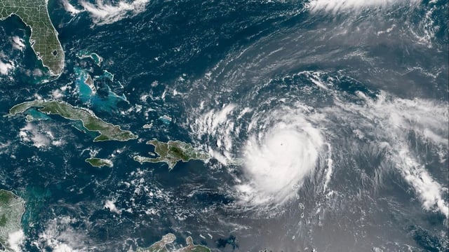
- Erin weakened from a peak of Category 5 with 160 mph winds to Category 4 as it moved west-northwest away from Puerto Rico and the northern Leeward Islands.
- Outer bands have unleashed heavy rain across Puerto Rico, prompting flood warnings in at least ten municipalities and leaving over 130,000 LUMA Energy customers without power.
- Hurricane watches and tropical-storm warnings remain in effect for the northern Leeward Islands and the U.S. and British Virgin Islands as agencies warn of flash flooding and landslides.
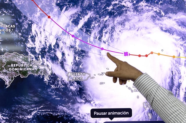
- Forecasters predict a gradual turn northward will keep Erin’s core offshore of the U.S. mainland, though dangerous surf and rip currents are expected to impact the Bahamas, Bermuda and parts of the U.S. East Coast.
- Mexico’s Conagua and SMN state that Erin poses no threat to Mexican territory based on its current distance and trajectory.