


Overview
- The National Hurricane Center reports sustained winds near 205 km/h and a broad wind field, with hurricane‑force winds reaching roughly 130 km from the eye and tropical‑storm‑force winds out to about 370 km.
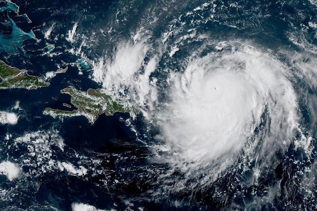
- The center is near the southeast Bahamas after crossing near Grand Turk, with localized downpours raising risks of flooding and landslides in the Bahamas, Haiti, and the Dominican Republic.
- Forecasts indicate a northward turn on Tuesday and a midweek pass between the U.S. East Coast and Bermuda, keeping the core offshore while maintaining widespread coastal hazards.
- NHC officials warn of powerful swells, dangerous rip currents, and coastal flooding, with waves up to about 6 meters and evacuation orders already issued for North Carolina’s Hatteras Island.
- Puerto Rico saw widespread power outages over the weekend, with service restored to more than 90% of customers, as Erin’s rapid intensification to Category 5 then fluctuations highlight concerns tied to unusually warm Atlantic waters in an expectedly active season.