
Overview
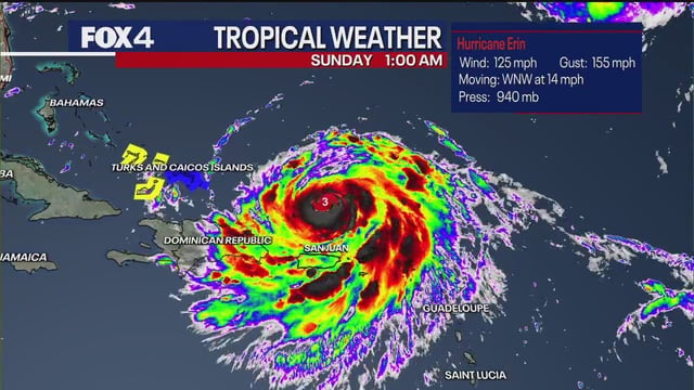
- The National Hurricane Center projects Erin will regain Category 4 strength before curving northeast away from the U.S. mainland.
- Dangerous surf, strong rip currents and potential beach erosion are forecast along the East Coast from Florida through Maine.
- Tropical storm warnings remain in effect for the Turks and Caicos and nearby Bahamas as Erin brings risks of flooding and landslides to those islands.
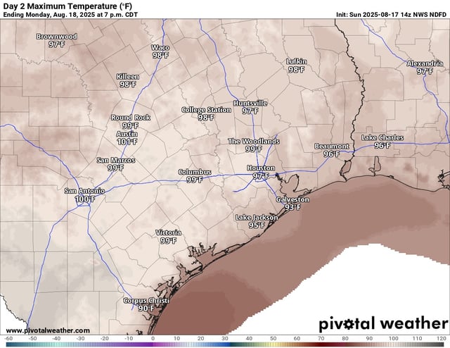
- A persistent heat dome is driving triple-digit highs in Austin, near-100°F temperatures in Houston and heat advisories for Dallas–Fort Worth through Monday evening.
- A weak frontal boundary is expected midweek to boost shower chances and drop North Texas highs into the low- to mid-90s by week’s end.