
Overview
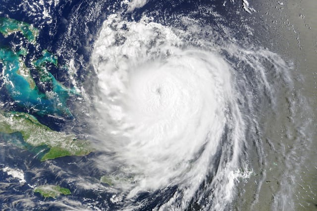
- As of early Thursday, Erin was about 205 miles east‑southeast of Cape Hatteras with 105 mph winds, moving north‑northeast at 17 mph, according to the National Hurricane Center.
- Outer Banks impacts included flooding and overwash that closed NC Highway 12 on Hatteras Island and cut access to Ocracoke’s ferry terminal, with coastal flooding also reported in parts of Virginia.
- A storm surge of 2 to 4 feet is possible from Cape Lookout to Duck during peak high tide Thursday evening, with tropical storm warnings from Beaufort Inlet, North Carolina, to Chincoteague, Virginia, and a tropical storm watch for Bermuda.
- Life‑threatening surf and rip currents are affecting much of the East Coast, with New York City beaches closed to swimming and waves over 10 feet forecast near Nantucket; an offshore buoy measured average wave heights near 40 feet.
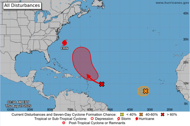
- Erin remains a very large hurricane with hurricane‑force winds extending 105 miles from its center, as the NHC also monitors two Atlantic disturbances with a 70% and 40% seven‑day development chance, respectively.