
Overview
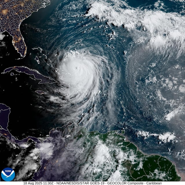
- Erin intensified to a Category 4 hurricane with 130 mph sustained winds on Aug. 18, and forecasters expect further strengthening as the storm turns north between the U.S. East Coast and Bermuda.
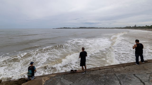
- Swells generated by Erin are forecast to produce life-threatening surf and rip currents along the Bahamas, Bermuda, the U.S. Atlantic coast and Atlantic Canada over the next several days.
- Dare County officials declared a state of emergency and issued a mandatory evacuation for Hatteras Island, requiring visitors to leave Aug. 18 and residents by the morning of Aug. 19.
- Hyde County declared an emergency for Ocracoke Island, ordering visitors to evacuate immediately and residents to begin departures at 6 a.m. on Tuesday.
- Portions of North Carolina Highway 12 on both barrier islands are expected to be impassable from Aug. 19 through Aug. 21 due to coastal flooding and ocean overwash, risking multi-day isolation and limited emergency access.