
Overview
- Erin has intensified into a Category 4 hurricane and is forecast to pass well east of the U.S. midweek, remaining offshore of New England and the Mid-Atlantic.
- Marine forecasts warn of 10–15 foot wave heights by Thursday, prompting beach hazards statements and marine advisories from Maine through New Jersey.
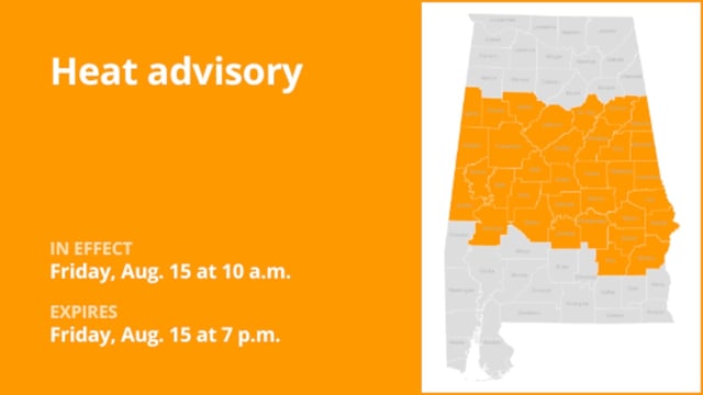
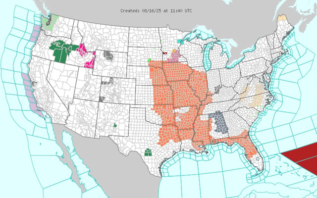
- Over the weekend more than 56 million people in 15 states were under heat alerts, with heat index values topping 112°F in parts of the Southeast and Central Plains.
- A cold front moving through the Midwest and Great Lakes spawned rounds of severe thunderstorms, triggering severe thunderstorm watches, flash-flood warnings and power outages for roughly 69,000 ComEd customers.
- That same front will bring isolated to scattered storms Sunday night into the Northeast before delivering a marked cooldown and drier, fall-like air early next week.