
Overview
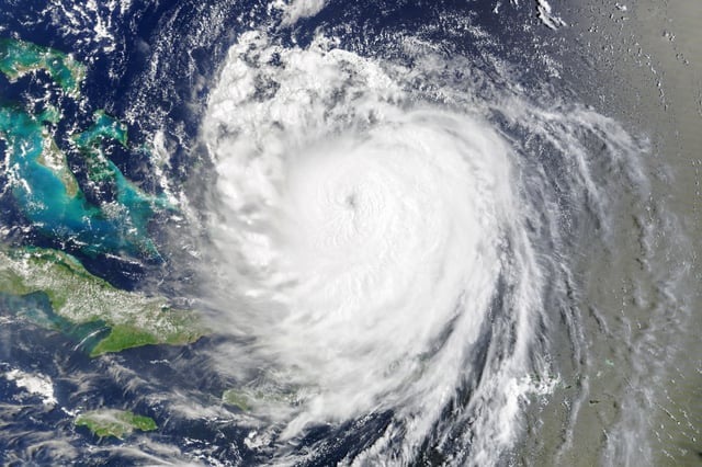
- At 5 a.m. ET, Erin was a Category 2 storm with 105 mph winds about 205 miles east‑southeast of Cape Hatteras, moving north‑northeast at 17 mph, the National Hurricane Center said.
- Tropical storm and storm surge warnings covered parts of North Carolina and Virginia with 2–4 feet of surge possible, and Bermuda was under a tropical storm watch.
- North Carolina’s Outer Banks saw overwash and flooding that closed Highway 12 on Hatteras Island and cut ferry access to Ocracoke, following evacuation orders for both islands.
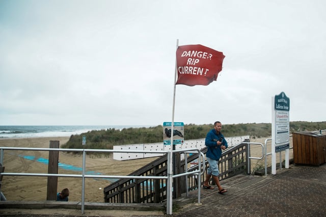
- Life‑threatening surf and rip currents extended from Florida to New England with beach swimming bans in New York City and restrictions in New Jersey, Delaware and Maryland, and forecasters warned of significant coastal flooding at several mid‑Atlantic sites.
- Forecast guidance shows the center tracking between the East Coast and Bermuda before passing south of Atlantic Canada Friday into Saturday and transitioning to post‑tropical, while two trailing Atlantic disturbances carry roughly 70% and 40% seven‑day development odds.