
Overview
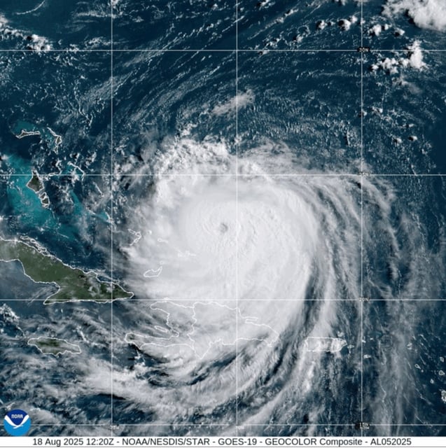
- The National Hurricane Center reported 140 mph sustained winds Monday while Erin was near the southeast Bahamas and Turks and Caicos under tropical storm alerts.
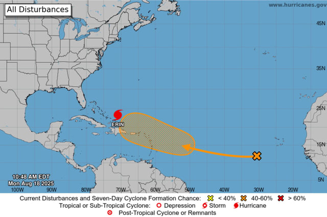
- Forecast guidance keeps the center offshore between Bermuda and the U.S. coast as the storm grows in size and drives life‑threatening surf and rip currents from the Bahamas and Bermuda to Atlantic Canada.
- North Carolina ordered mandatory evacuations for Hatteras and Ocracoke islands, warning that N.C. Highway 12 could be impassable for days as coastal flooding and overwash develop Tuesday through Thursday.
- Outer bands drenched Puerto Rico and the U.S. Virgin Islands, cutting power to about 147,000 customers before service was restored to more than 96% by early Monday and ports reopened.
- Hazardous seas will intensify along much of the East Coast, with 20‑plus‑foot breakers and dune damage likely on the Outer Banks and dangerous rip currents reaching as far north as New York and Long Island.