
Overview
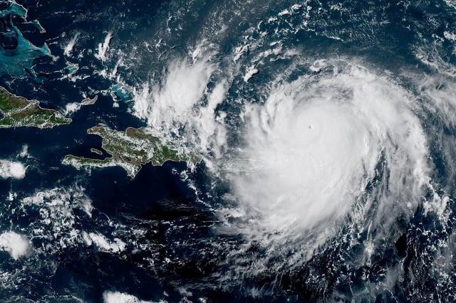
- The National Hurricane Center reported that Erin regained Category 4 status Sunday night with sustained winds near 215 km/h around Grand Turk.
- Forecasters warn Erin could unleash up to 200 mm of rain in isolated areas, raising the risk of flooding and landslides as it nears the Bahamas.
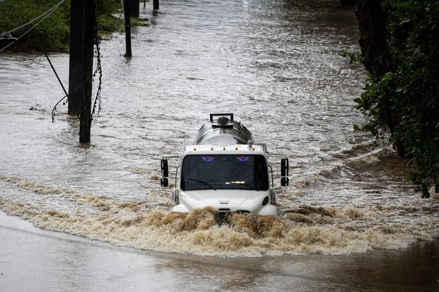
- Large swells are already driving coastal erosion and prompted evacuation orders for Hatteras Island in North Carolina.
- Rough seas have knocked out power for roughly 155,000 customers in Puerto Rico, utility operator Luma said.
- Climate researchers link Erin’s rapid intensity swings to unusually warm sea surface temperatures amid an above-normal hurricane season.