

Overview
- The National Hurricane Center reports that Erin regained Category 4 strength Monday with sustained winds near 130 mph and is expected to remain a dangerous major hurricane into midweek.
- Erin’s enlarged wind field is generating dangerous surf, rip currents and coastal flood warnings from the southeastern Bahamas through Bermuda and up the U.S. East Coast to Atlantic Canada.
- Dare and Hyde counties in North Carolina declared states of emergency and ordered staggered mandatory evacuations for Hatteras and Ocracoke islands as storm-driven overwash threatens to render sections of Highway 12 impassable for days.
- Outer bands of Erin dumped heavy rain across Puerto Rico over the weekend, cutting power to about 147,000 Luma Energy customers before service was largely restored by Monday morning.
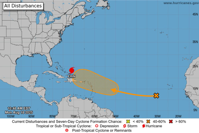
- Forecasters are also monitoring a separate tropical wave in the eastern Atlantic with roughly a 50 percent chance of development into a tropical depression over the next seven days.