Overview
- Erin weakened to Category 1 with 90 mph winds Friday as it accelerated northeast, beginning a transition to a post-tropical, hurricane‑force low expected by Friday night.
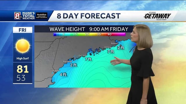
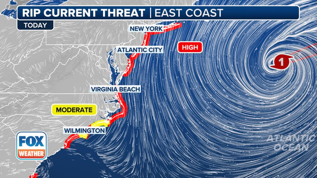
- Life‑threatening rip currents and high surf persist from the Carolinas to New England, with coastal flood and high‑surf advisories posted in several areas, including along the Maine coast.
- North Carolina’s Outer Banks saw dune breaches, overwash and closures on NC Highway 12 after evacuations moved more than 2,200 people and 1,100 vehicles from Ocracoke.
- States reported tidal flooding and beach restrictions, including road closures in parts of New Jersey, as officials warned swimmers to stay out of hazardous waters after numerous rip‑current rescues.
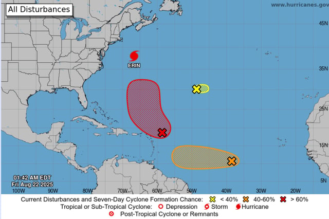
- The National Hurricane Center is tracking multiple disturbances, with Invest 90L given a high chance of development in the coming days and Invest 99L carrying lower, uncertain odds.