Overview
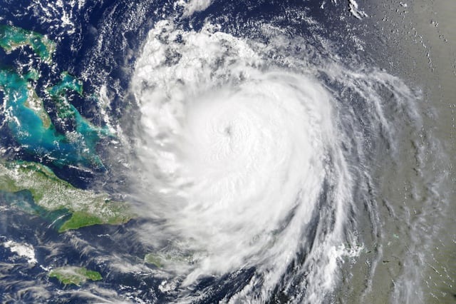
- The Category 2 hurricane had 105 mph winds early Thursday about 205 miles east‑southeast of Cape Hatteras, moving north‑northeast at 17 mph, according to the National Hurricane Center.
- High waves flooded and closed sections of North Carolina’s Highway 12 and severed Ocracoke’s ferry access after mandatory evacuations on Hatteras and Ocracoke islands.
- Storm surge of 2 to 4 feet was forecast for parts of coastal North Carolina with 1 to 3 feet possible north to Sandy Hook, New Jersey, as coastal flooding spread into Virginia and the Mid‑Atlantic.
- Beaches restricted swimming from the Carolinas to New York, and rescue teams reported dozens of rip‑current saves as the unusually large storm pushed hazardous surf from the Bahamas to Atlantic Canada.
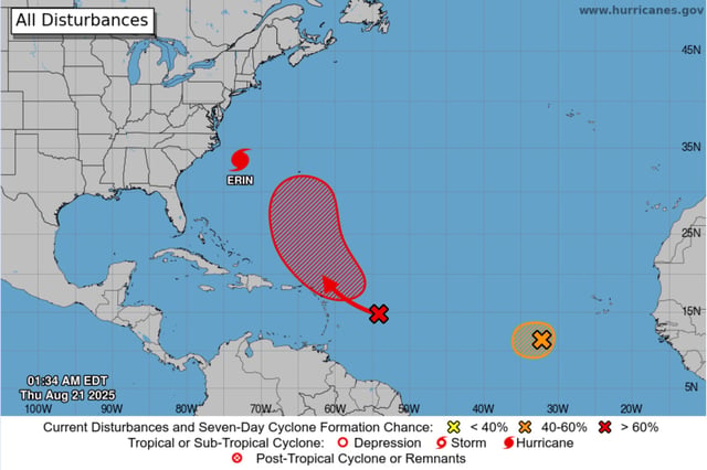
- Forecasters expect Erin to track farther out to sea and gradually weaken to a post‑tropical system within days, while two Atlantic disturbances carry roughly 70% and 40% chances of development.