Overview
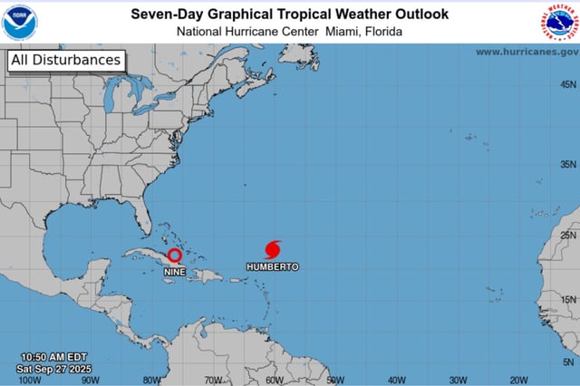
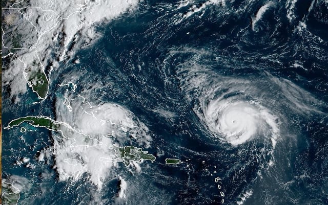
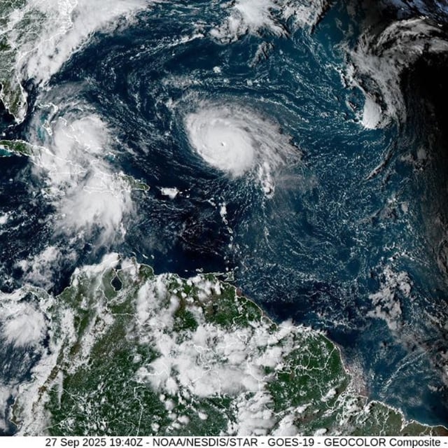
- Tropical Depression Nine, expected to be named Imelda, is crossing the Bahamas this weekend and could reach hurricane intensity near the Southeast U.S. coast early next week, according to the National Hurricane Center.
- Tropical-storm warnings are in effect for the central and northwestern Bahamas, and a tropical-storm watch covers Florida’s east coast from the Palm Beach–Martin County line to the Volusia–Flagler line.
- South Carolina declared a statewide emergency and Charleston issued a local emergency as officials brace for heavy rain, storm surge and gusty winds even without a guaranteed landfall.
- The forecast carries higher-than-usual uncertainty due to a possible Fujiwhara-like interaction with Major Hurricane Humberto, an approaching front and upper-level disturbance, with hurricane hunters and extra weather balloon launches gathering data.
- Humberto, a Category 4 with 145 mph winds, is forecast to remain a major hurricane and generate hazardous swells for the northern Leewards, the Virgin Islands, Puerto Rico and Bermuda, with U.S. East Coast surf impacts expected early in the week; NHC guidance also calls for 4–8 inches of rain in the Bahamas, 8–12 inches in eastern Cuba (locally 16), and up to 3 feet of surge in the northwestern Bahamas.