Overview
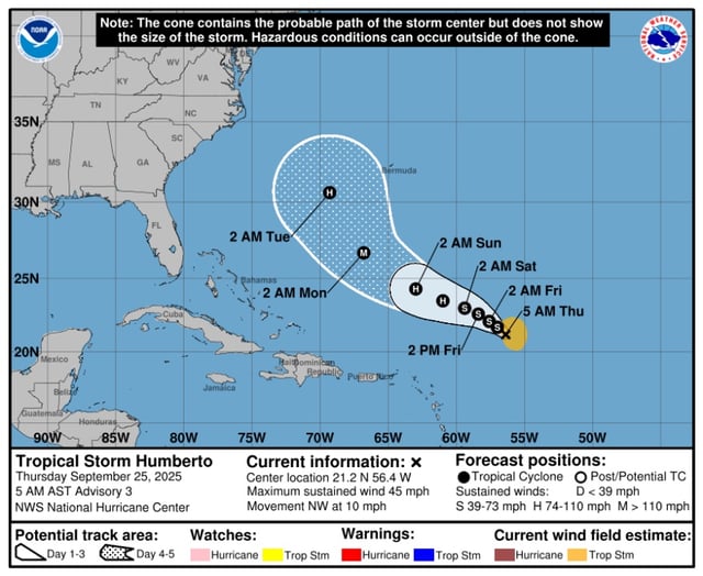
- Tropical Storm Humberto sits several hundred miles east-northeast of the northern Leeward Islands with 45 mph winds and is moving west-northwest to northwest near 10–12 mph, according to the National Hurricane Center.
- Forecasters expect Humberto to become a hurricane within a couple of days and potentially reach major hurricane strength by early next week.
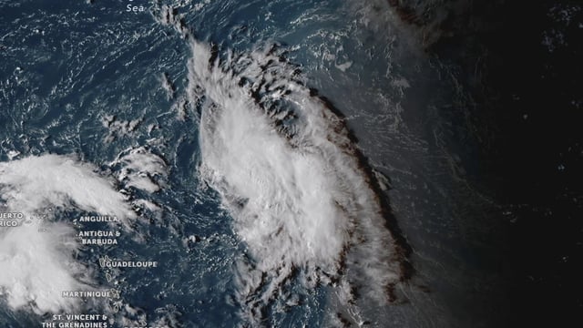
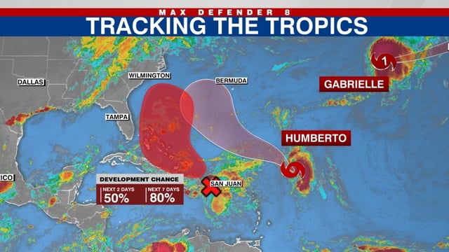
- A separate system, Invest 94L near Puerto Rico and Hispaniola, is producing heavy rain with flood and landslide risk and carries about a 50% chance of development in 48 hours and 80% within a week.
- Model guidance highlights possible interaction between Humberto and 94L, plus a turn northward later due to an approaching trough, leaving significant uncertainty for the Bahamas, Bermuda and the U.S. East Coast.
- No coastal watches or warnings are in effect for Humberto, but NOAA Hurricane Hunter flights are gathering data to refine forecasts and dangerous swells and rip currents remain possible along parts of the East Coast.