Overview
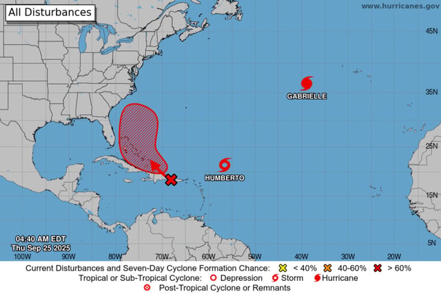
- The National Hurricane Center said Humberto has sustained winds near 45 mph about 480–505 miles east-northeast of the northern Leeward Islands and is forecast to become a hurricane this weekend, with a chance to reach major strength early next week.
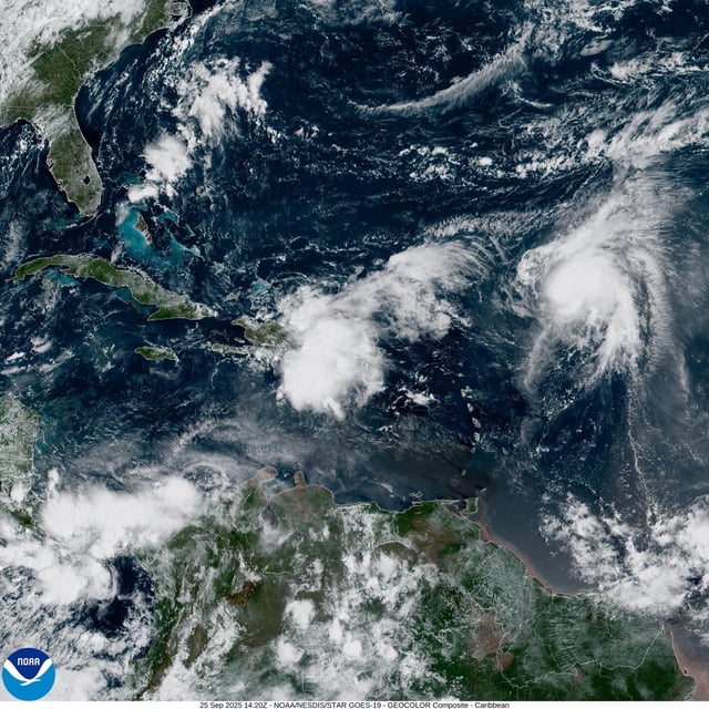
- A disturbance designated Invest 94L near Puerto Rico and the Dominican Republic carries a 50% formation chance in 48 hours and 80% in seven days, with a tropical depression likely near the Bahamas late this week after producing heavy rain and gusty winds in the northern Caribbean.
- Proximity between Humberto and Invest 94L could enable a Fujiwhara interaction, and model guidance remains split, with faster eastward solutions versus slower westward tracks that include scenarios from offshore recurvature to a closer approach to the Carolinas early next week.
- Hurricane Gabrielle has prompted hurricane warnings for the Azores, where the NHC warns of storm surge, damaging winds and 3–5 inches of rain, and its swells are producing life‑threatening surf and rip currents from Bermuda to the U.S. East Coast north of North Carolina and into Atlantic Canada.
- Even if the systems remain offshore, forecasters expect rough surf and rip currents along parts of the U.S. East Coast and the Bahamas beginning this weekend, and they urge communities in the Bahamas, Bermuda and the Southeast U.S. to monitor NHC updates.