


Overview
- Forecasters say an area of high pressure will steer both systems east of the mainland Tri‑State, limiting impacts to higher surf, dangerous rip currents and possible beach erosion.
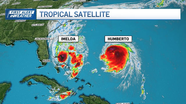
- Hurricane Humberto remains a Category 4 over the Atlantic and is generating large swell that will focus impacts on New England, especially Cape Cod and the Islands.
- Tropical Storm Imelda, which drenched the Bahamas over the weekend, is expected to strengthen toward Category 1 as it moves toward Bermuda, sustaining a high rip‑current risk through midweek.
- A cold front on Wednesday will enhance northeasterly winds with coastal gusts near 30–35 mph and drop temperatures to the 60s Wednesday and upper 50s Thursday in parts of New England.
- Marine alerts include high rip‑current advisories in parts of New Jersey, small craft advisories through Friday, minor coastal flooding potential through Friday and 5–10 foot waves Wednesday along the Cape and Islands with elevated seas lingering Thursday.