Overview
- At 5 a.m. EDT, the NHC said Hurricane Humberto remained an extremely dangerous Category 4 with 155 mph winds, expected to turn north-northeast and pass west of Bermuda by Tuesday.
- Swells from Humberto are forecast to produce life‑threatening surf and rip currents across the northern Leewards, Virgin Islands, Puerto Rico, Bermuda and the U.S. East Coast beginning Monday.
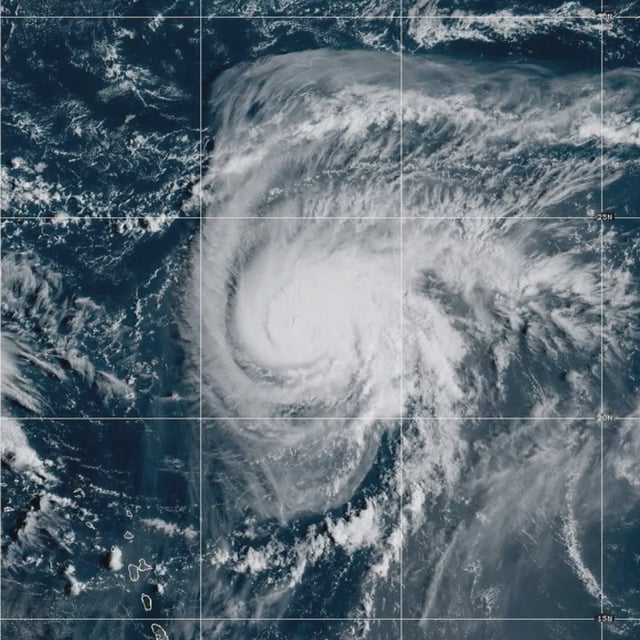
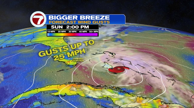
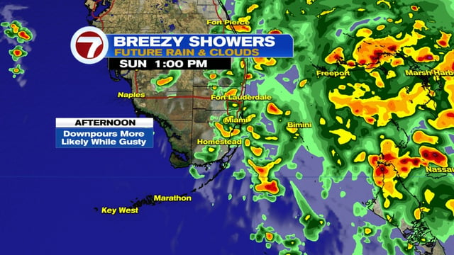
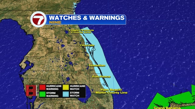
- Tropical Depression Nine held 35 mph winds over the Bahamas while moving north‑northwest near 7 mph, with forecasts calling for naming as Imelda later today and possible hurricane strength by late Monday or Tuesday near the Southeast coast.
- Tropical storm warnings cover much of the central and northwestern Bahamas, with a tropical storm watch posted for Florida’s east coast from the Palm Beach/Martin County line to the Flagler/Volusia County line; South Carolina urged preparedness and North Carolina declared an emergency.
- Forecasters expect 4–8 inches of rain across eastern Cuba and the Bahamas and 3–6 inches, locally up to 10 inches, from Florida into the Carolinas, with track confidence reduced by the potential for storm interaction.