Overview
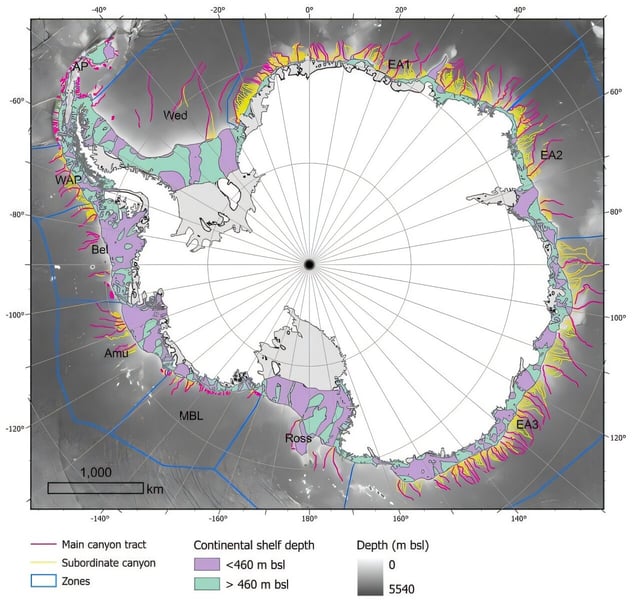
- The publicly released catalog identifies 332 submarine canyon networks around Antarctica, a fivefold increase over previous inventories, using the high-resolution IBCSO v2 dataset and a novel semi-automated protocol.
- Some canyons reach depths exceeding 4,000 meters and show pronounced morphological differences, with complex, branched U-shaped systems in East Antarctica and shorter, steeper V-shaped valleys in the West.
- These underwater formations drive oceanographic processes by channeling warm Circumpolar Deep Water toward ice shelves and contributing to Antarctic Bottom Water formation through deep-cold water exchange.
- Authors warn that climate and ocean circulation models, including those used by the IPCC, fail to capture local-scale canyon processes, undermining forecasts of ice-shelf thinning and sea-level rise.
- Researchers are advocating for expanded high-resolution bathymetric surveys and the integration of canyon-scale dynamics into climate projections to refine understanding of Antarctic stability and global climate impacts.