
Overview
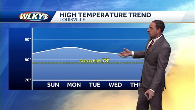
- Much of the country stays warmer than normal with limited rain under a persistent high-pressure ridge, with localized morning fog reported in low-lying areas.
- Hurricane Humberto has intensified to Category 5 over the open Atlantic; forecasters expect rough surf along parts of the U.S. East Coast and note possible effects near Bermuda later next week.
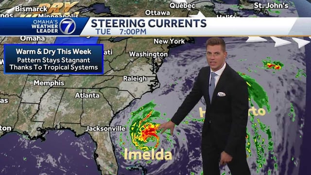
- Tropical Depression Nine is expected to become Tropical Storm Imelda, and the National Hurricane Center has issued tropical-storm watches for portions of Florida’s east coast.
- Recent model guidance and NHC tracks lean toward keeping Imelda offshore, though heavy rain, coastal flooding, high surf and rip currents remain possible for coastal Georgia and the Carolinas.
- Many inland areas anticipate minimal direct tropical impact, though some locales add midweek shower chances, with a late-week cool down bringing patchy frost risk in northern and interior regions.