
Overview
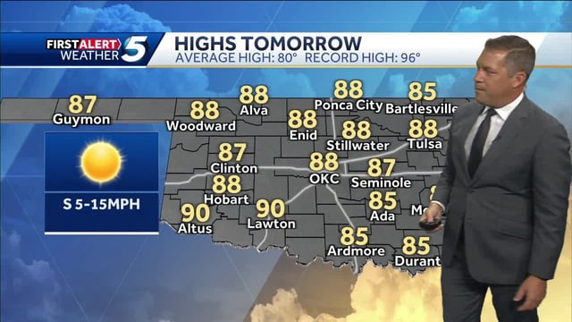
- Many areas turn sunny and unseasonably warm through the weekend under a broad high, with highs in the 70s to low 80s inland and upper 80s to near 90 in parts of the South.
- Dense Fog Advisories affected limited zones early Friday and forecasters note localized overnight and early‑morning fog may recur where skies clear and winds stay light.
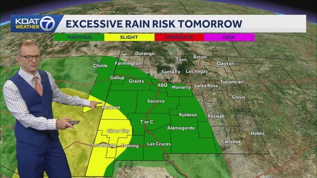
- Rain and thunderstorms are forecast to develop Saturday in parts of the Mid-Atlantic, with locally heavy downpours, frequent lightning and gusty winds possible before gradual improvement Sunday.
- Hurricane Humberto and an invest likely to become Imelda are being monitored by the NHC, and model guidance will determine whether their interaction with a nearby front brings indirect rain to the Southeast and Mid-Atlantic early next week; direct impacts farther north remain unlikely for now.
- A stronger Canadian high and trailing cold front are expected to usher in cooler, drier air by mid‑to‑late next week across the East, with some New England locales trending toward 50s–60s for highs and chilly nights.